
| Data and Documentation | Chronology and News | Program Status | Publications | Related Data and Resources | Contact Points |
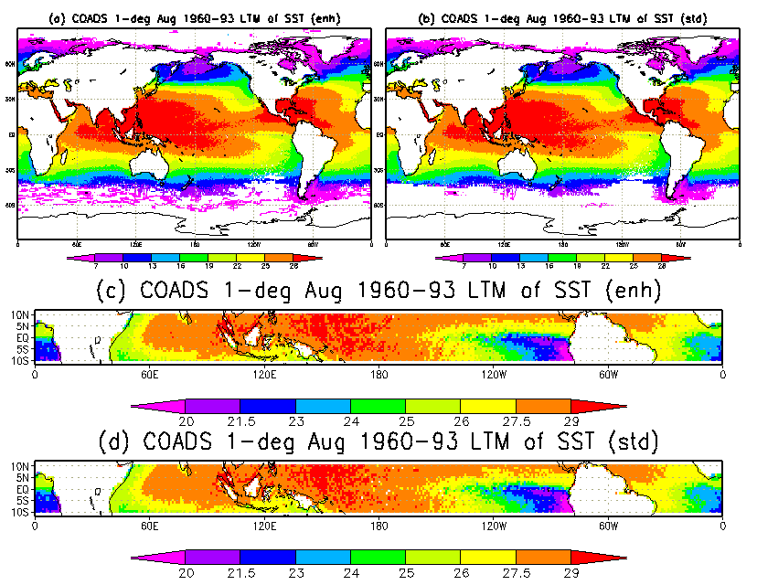
Long-term (1960-93) mean sea surface temperature for August based on COADS 1-degree latitude x 1-degree longitude monthly summaries completed in support of NOAA's Pan-American Climate Studies (PACS) Program. The four parts of this figure illustrate for one month the two spatial domains and the two statistics versions available: (a) Global enhanced (ships plus other platforms; 4.5 sigma trimming); (b) Global standard (ships only; 3.5 sigma trimming); (c) Equatorial enhanced (as in (a), but for a 21-degree latitude strip centered on the Equator); and (d) Equatorial standard (as in (b), but for a 21-degree latitude strip centered on the Equator).
U.S. National Oceanic and Atmospheric Administration hosts the icoads website privacy disclaimer
Document maintained by icoads@noaa.gov
Updated: Nov 8, 2005 23:51:38 UTC
http://icoads.noaa.gov/pacs.html