
| Data and Documentation | Chronology and News | Program Status | Publications | Related Data and Resources | Contact Points |
ICOADS Web information page (Friday, 14-Jul-2006 23:54:00 UTC):
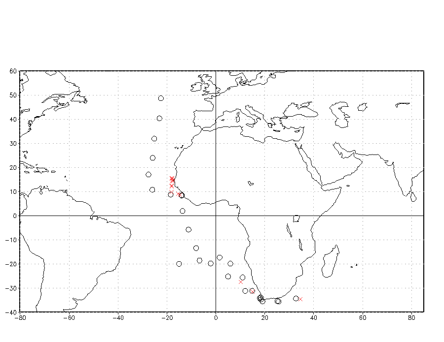
Figure 4a.
Positions, at local noon, reported in the Ship's Log from the Cumberland during July 1940 (black). Local noon positions from deck 204, which fell within ±10° latitude/longitude of each corresponding Cumberland position, are shown in red.
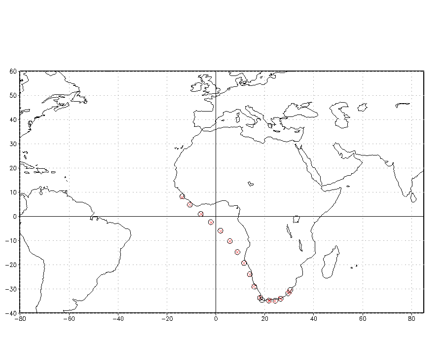
Figure 4b. As for Figure 4a, except for the Alcantara during December 1942.
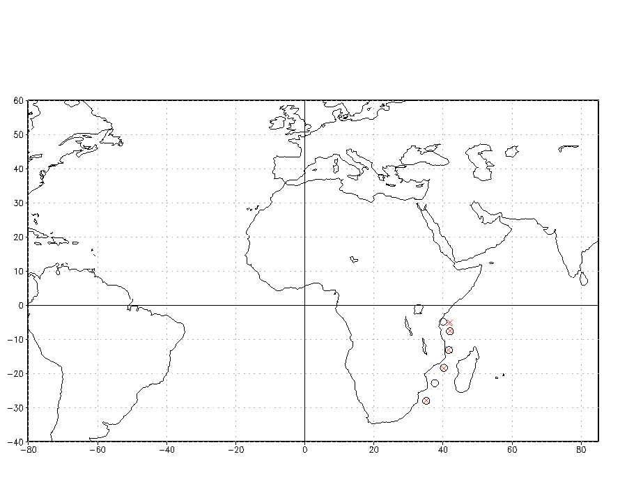
Figure 4c. As for Figure 4a, except for the Resolution during May 1943.
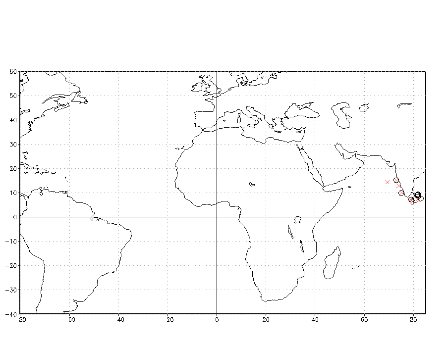
Figure 4d. As for Figure 4a, except for the Shah during May 1944.
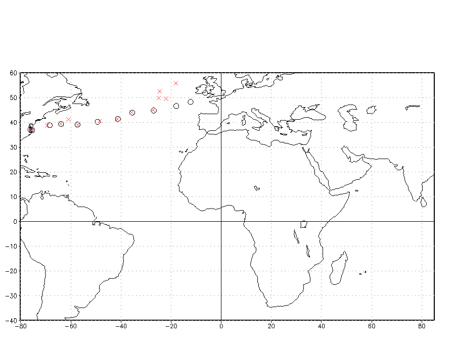
Figure 4e. As for Figure 4a, except for the Ruler during October 1944.
[Links to detailed][UK RN WW II Logs and the MDB]
U.S. National Oceanic and Atmospheric Administration hosts the icoads website privacy disclaimer
Document maintained by icoads@noaa.gov
Updated: Jul 14, 2006 23:54:00 UTC
http://icoads.noaa.gov/ukrn_ww2_mdb_fig4.html