
| Data and Documentation | Chronology and News | Program Status | Publications | Related Data and Resources | Contact Points |
ICOADS Web information page (Monday, 28-Apr-2014 17:39:41 UTC):
Release 1 NCDC Landlocked and Limits: GrADS Files
The NCDC quality control ("NCDC-QC") processing step was originally described in supp. J of COADS Release 1 (Slutz et al., 1985) as:
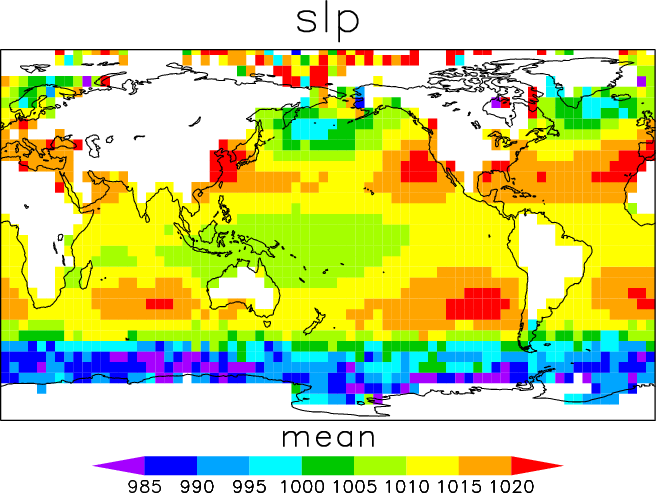
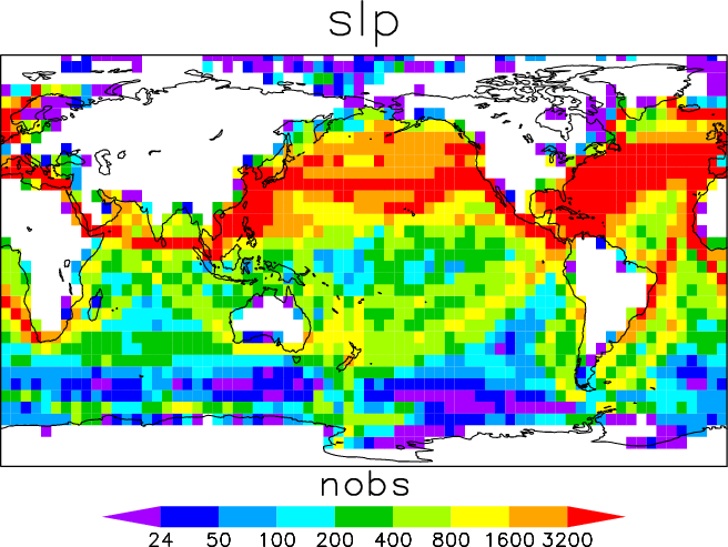
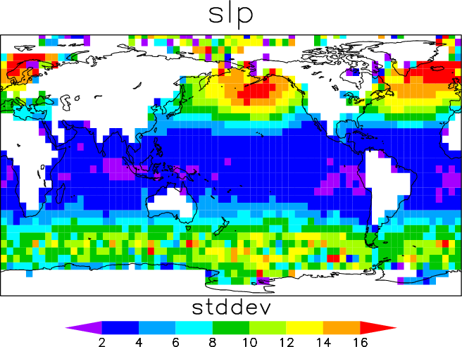
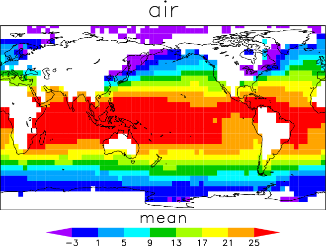
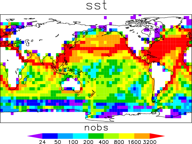
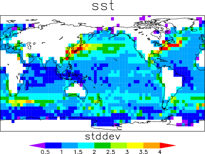
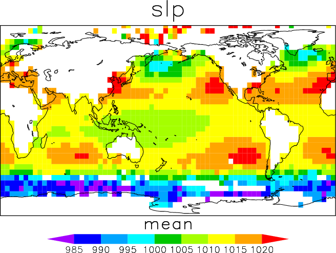
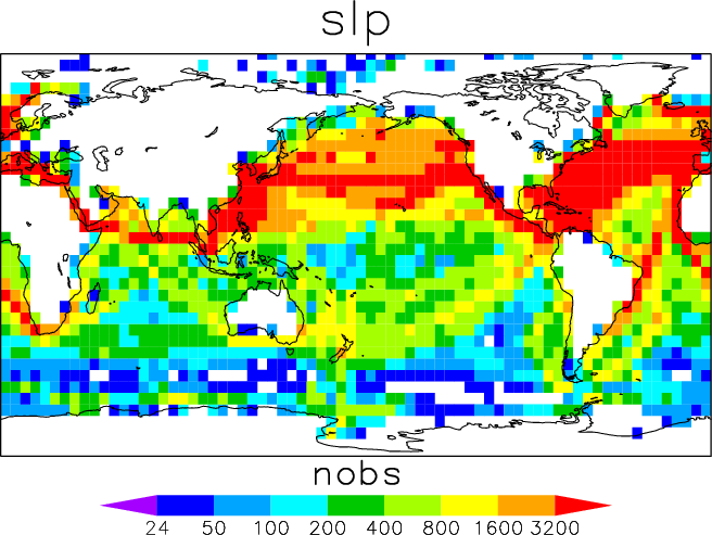
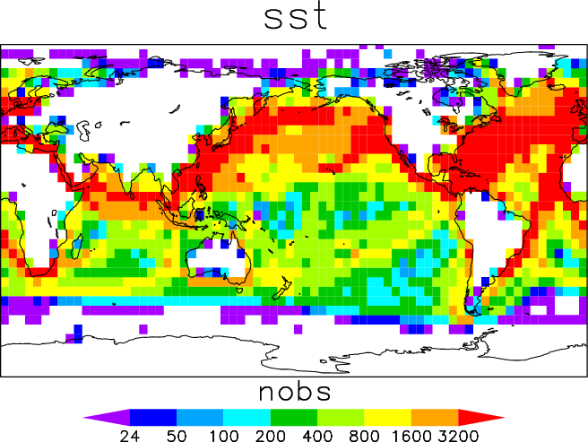
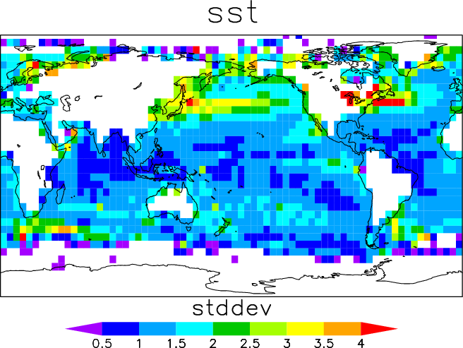
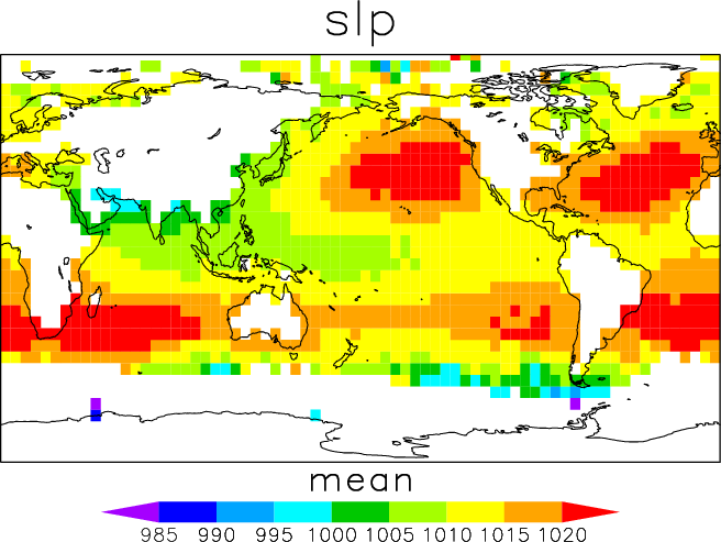
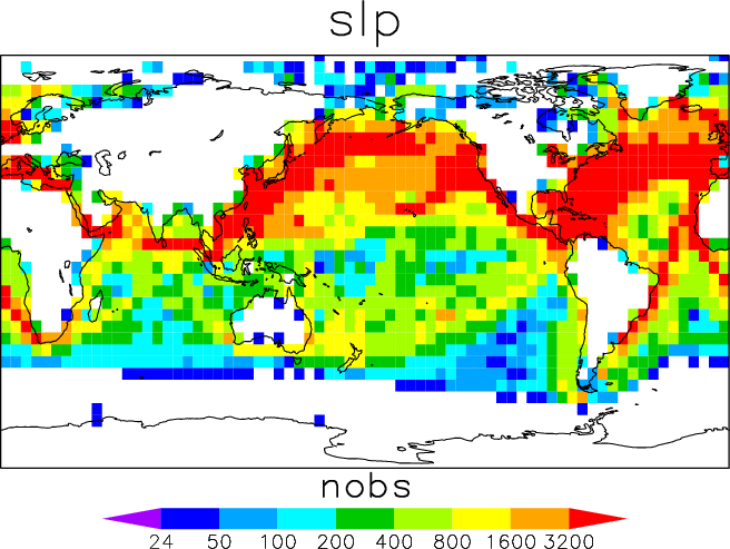
"...an important part of the duplicate elimination program (described in supp. K) because it provides a measure, in the form of a quality code, to judge which report among duplicates is retained. The quality code assigned to each report is the sum of the weights associated with the 14 flags given by Table J0-1, where the weight and the general meaning of each possible flag value is given by Table J0-2."For this NCDC-QC step, which remains an important part of ICOADS processing, an "NCDC Landlocked and Limits" file (supplied by NCDC in 1981) provided the 5°x5° box long-term monthly means and standard deviations needed to assign L (suspect) and Q (erroneous) flags, on the condition that number of observations per box is at least 25.
For easier use, we reformatted the limits part of the NCDC Landlocked and Limits file into data (and control; ctl) files in the Grid Analysis and Display System (GrADS) format. The 1° landmask (LNDLMT) part of this file can be viewed and accessed on this separate webpage.
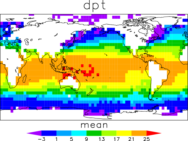
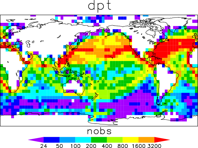
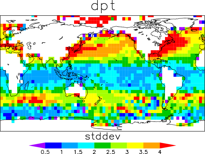
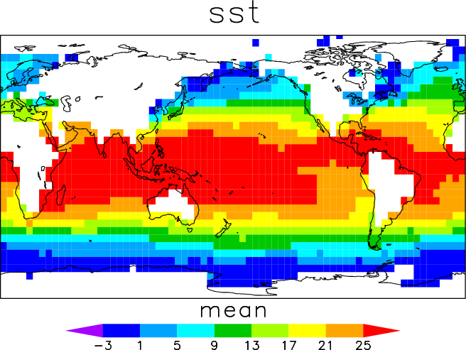
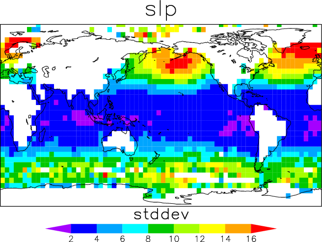
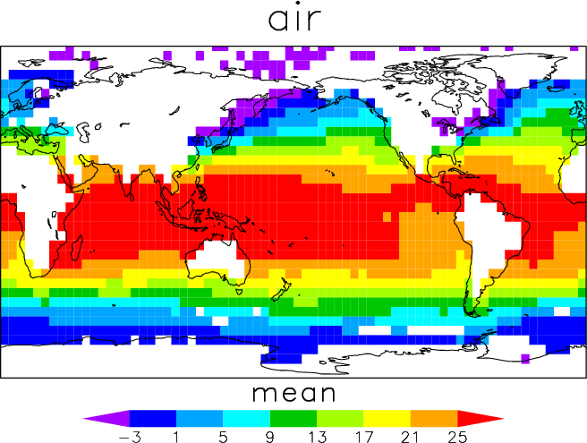
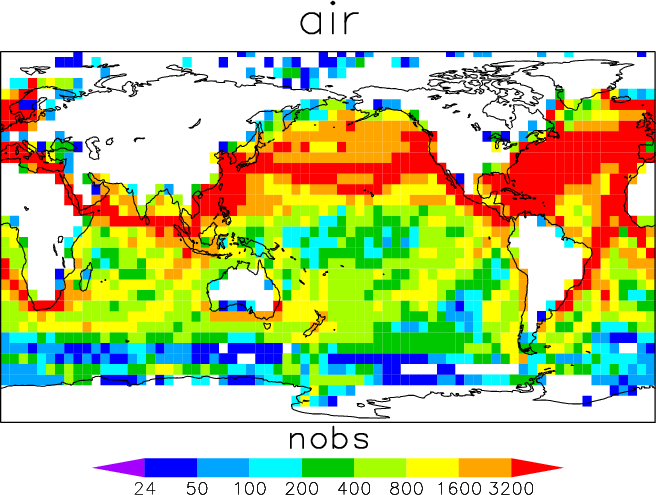
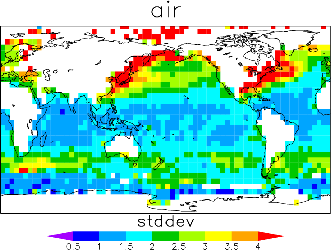
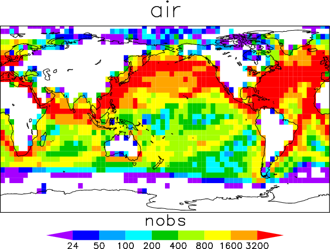
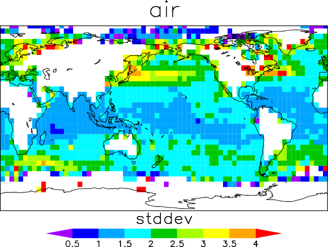
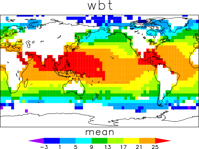
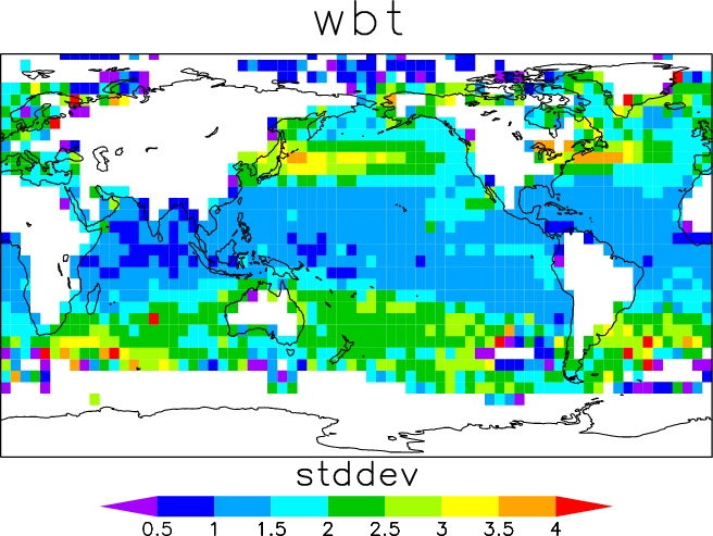
1. GrADS files
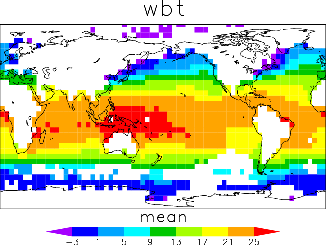
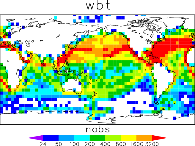
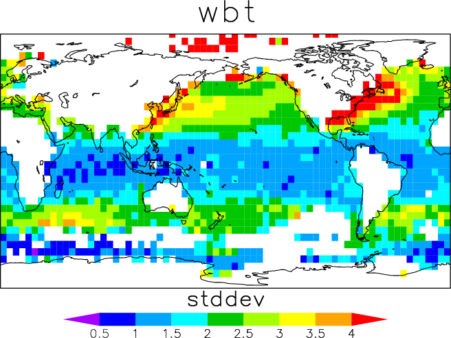
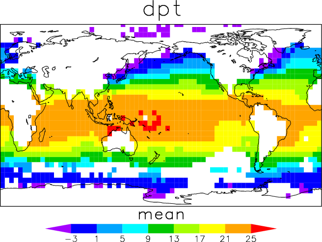
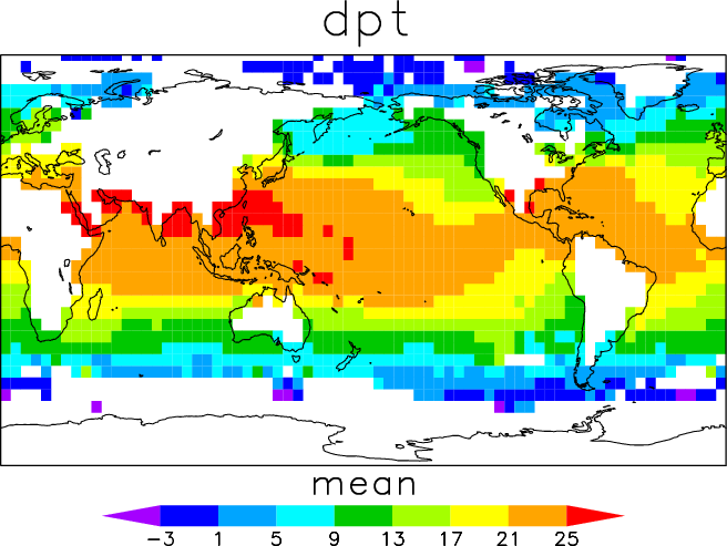
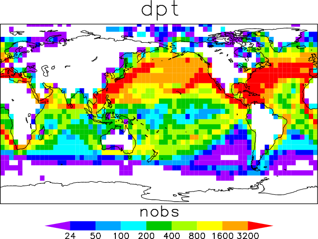
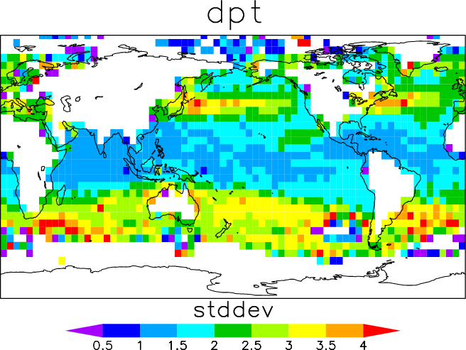
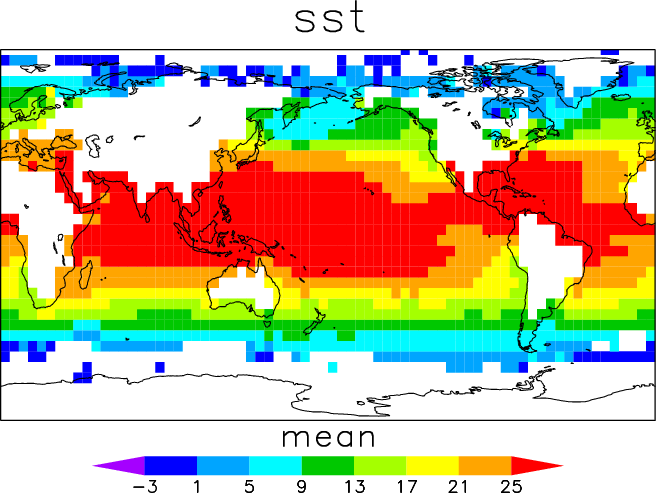
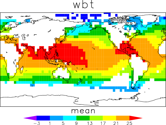
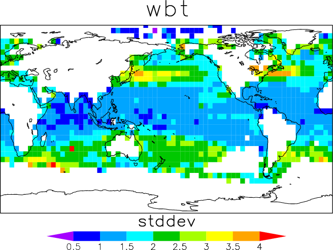
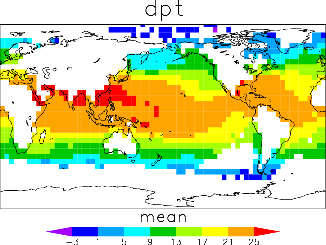
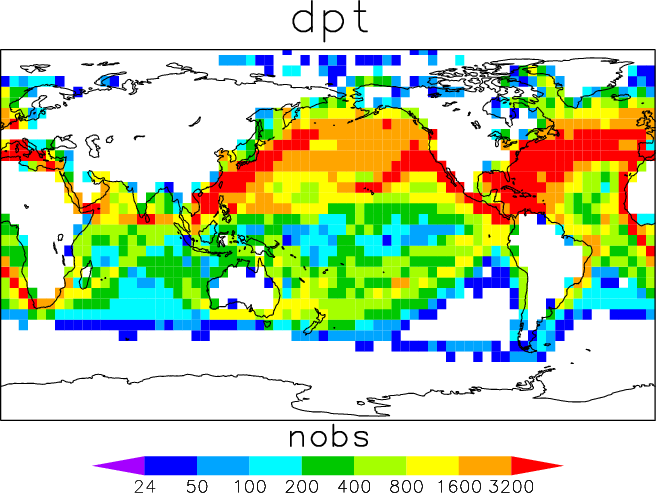
The first part of each file name indicates the variable:
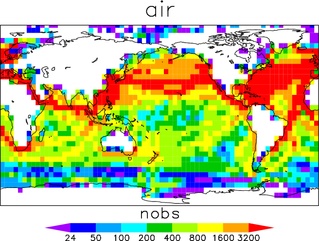
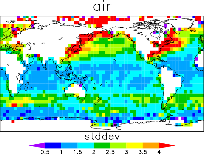
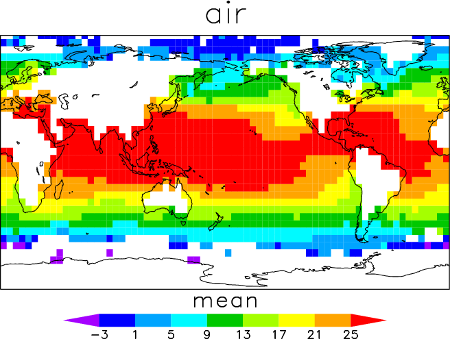
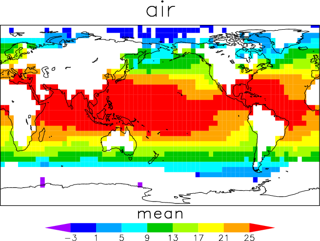
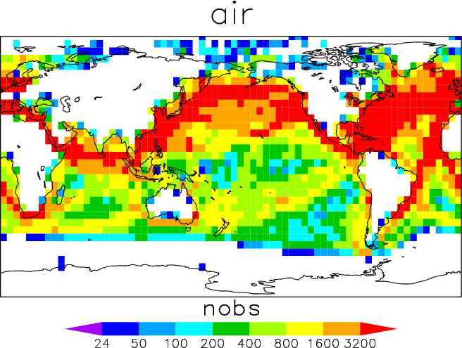
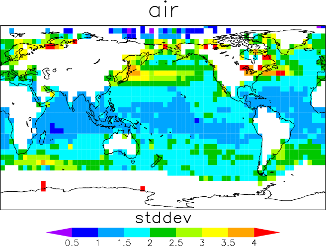
| air | air temperature | |
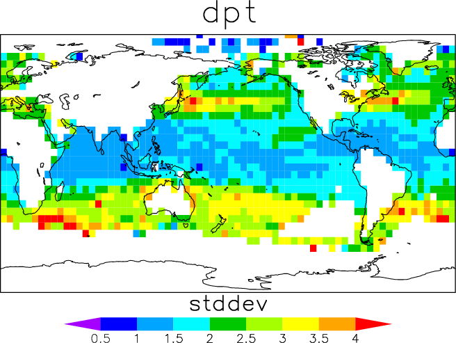
| dpt | dew point temperature | |
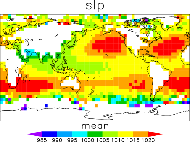
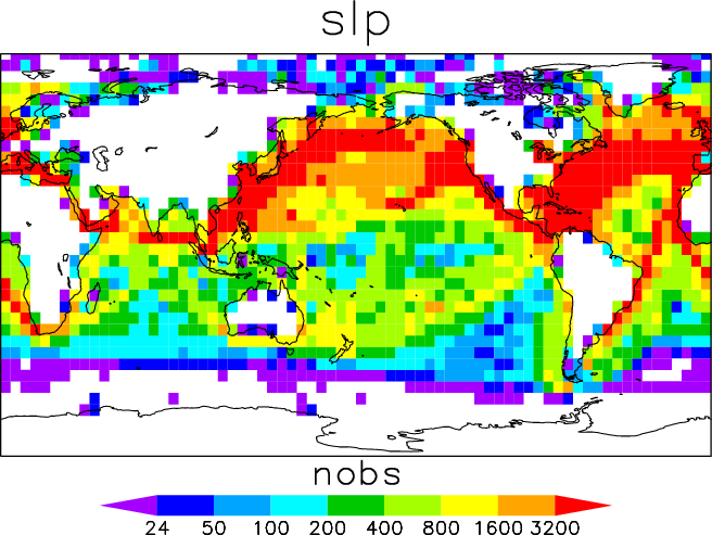
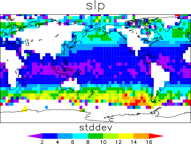
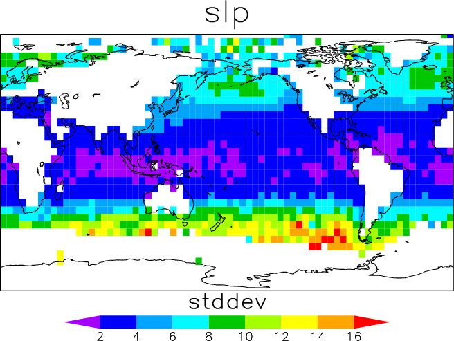
| slp | sea level pressure | |
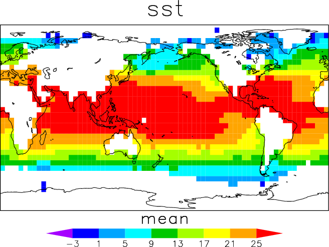
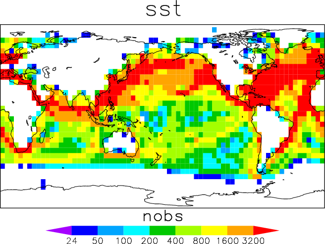
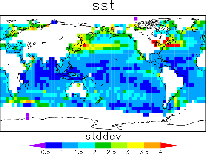
| sst | sea surface temperature | |
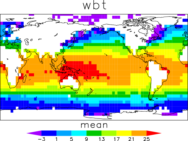
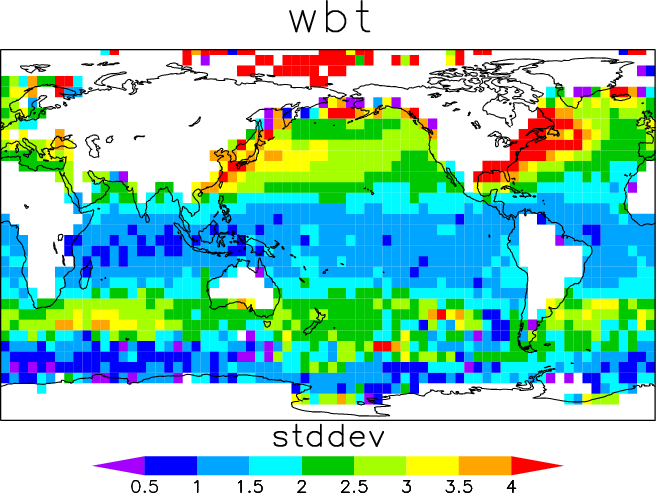
| wbt | wet bulb temperature |
and the second part of the file name indicates the statistic:
| mean | mean | |
| nobs | number of observations | |
| stddev | standard deviation |
Following are links to the GrADS data (compressed) and control files:
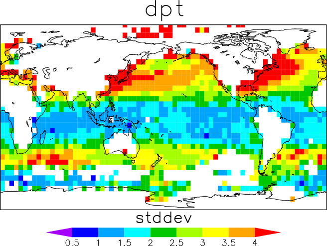
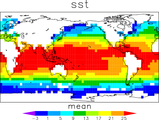
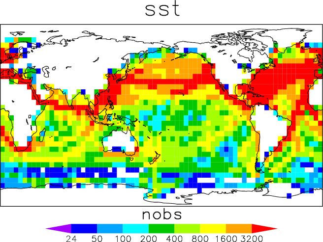
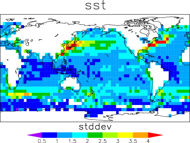
2. Sample plots
| 
| 
|
| 
| 
|
| 
| 
|
| 
| 
|
| 
| 
|
| 
| 
|
| 
| 
|
| 
| 
|
| 
| 
|
| 
| 
|
| 
| 
|
| 
| 
|
| 
| 
|
| 
| 
|
| 
| 
|
| 
| 
|
| 
| 
|
| 
| 
|
| 
| 
|
| 
| 
|
[Documentation and Software][Links to additional]
U.S. National Oceanic and Atmospheric Administration hosts the icoads website privacy disclaimer
Document maintained by icoads@noaa.gov
Updated: Apr 28, 2014 17:39:41 UTC
http://icoads.noaa.gov/lndlmt.html